This is the best route finder app available today: mapquest driving directions! Step-by-step directions for your driving or walking, plan your next road trip, discover interesting places nearby that you never knew existed, and share all the locations with your friends. Update road conditions, and live traffic at the routes at all time frames.
Driving from Atlanta to New York – Route and Route Tips
The fastest route takes about 14 hours to drive 880 miles, which is possible in a couple of days if you have a few people to share the driving. Before reaching Manhattan, you’ll travel through Georgia, South Carolina, North Carolina, Virginia, Maryland, Pennsylvania, and New Jersey on various interstate routes. You can also travel a different route that passes through Washington, D.C., Baltimore, and Philadelphia. Regardless of the route you take, there will be much to see along the way.
The most beatutiful trail
There are a variety of ways to get from Atlanta to New York City; use this one as a starting point. If you want to take the scenic route, you will pass through various national forests that may be mountainous, so be sure to verify road conditions. The Blue Ridge Parkway, one of the most scenic routes in the United States, is included in this itinerary.
To begin, travel north on US Highway 23 from Atlanta to Asheville, North Carolina. The Blue Ridge Parkway connects Asheville to Roanoke, Virginia, which is located in the Blue Ridge Mountains.
Continue east on Highway 460 through Lynchburg, Virginia, then north on Highway 29 toward Charlottesville. Pass through Frederick, Maryland, and then enter Pennsylvania on Highway 15 and follow Highway 30 through Lancaster County.
Take I-476 north to Allentown, PA, and then I-78 east to New York City, your final destination.
Tips for a road trip
Pack Non-Perishable Food: You’ll be passing through a lot of national parks on this journey, and there won’t be a lot of quick dinner options. Bring a jar of peanut butter, bread, fruit, granola bars, beef jerky, and other non-refrigerable goods that are ideal for a roadside picnic. Also, bring a blanket!
Start the Games Early: No one wants to try to encourage fatigued children to play a game. Before younger passengers lose interest, start your journey with a couple of games like I Spy or the License Plate Game.
Bring an Overnight Bag: No one wants to carry many suitcases into a hotel after a long day of driving. Pack an overnight bag or carry-on luggage with pajamas, toiletries, and a change of clothes, as well as any valuables you don’t want to leave in your vehicle overnight, to make your life easier.
There are five stops to make along the way:
LANCASTER COUNTY, PENNSYLVANIA
Why would you travel via a random Pennsylvania county? It’s an opportunity to experience how the Amish, sometimes known as Pennsylvania Germans, live their lives, which are largely devoid of technology. Because this area has a strong Amish population, don’t be shocked if you see a horse and carriage on the road! On the journey, you can come across some Amish people.
THE ESTATE OF BILTMORE
If you’re ever in the area of Asheville, North Carolina, stop at this lavish mansion, which was completed in 1895. One of the Vanderbilts built it as a summer house, and walking around the lush gardens and seeing the chambers will make you feel like royalty.
ROANOKE, VIRGINIA
Just for the view, this village nestled in the Blue Ridge Mountains is worth a visit. It’s also near the northern end of the Blue Ridge Parkway, so it’s an excellent place to stop for a bite to eat or stock up on supplies before continuing on.
NATIONAL PARK OF SHENANDOAH
This national park, which stretches along the Blue Ridge Mountains, is home to a diverse range of species, rugged scenery, and waterfalls. If you want to get some fresh air on your drive, this is the place to go hiking or camping.
NATIONAL HISTORIC SITE OF MARTIN LUTHER KING JR.
When you visit this historical park in Atlanta, you can start your journey with a little of history. You may see the boyhood home of the civil rights icon, as well as Ebeneezer Baptist Church, where he spoke.
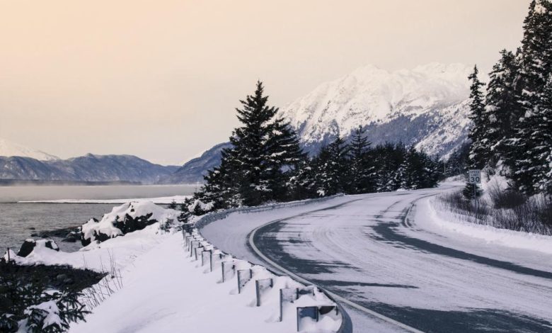
Is it possible to drive from Alaska to The United States?
You can drive to Alaska from anywhere in the United States except Hawaii. Use the mapquest driving directions to find the fastest way. The Alaska Highway is the sole main road between Alaska and the rest of the United States. You will ultimately join the Alaska Highway, regardless of where you begin in the United States or Canada.
The Alaska Highway was created during World War II to connect the Lower 48 States to Alaska without having to travel by sea. It first opened to the public in 1948.
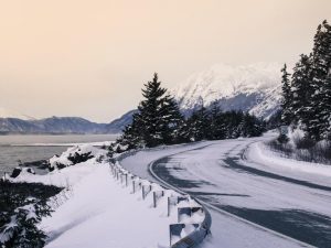
British Columbia Highway 97, Yukon Highway 1, and Alaska Route 2 are the three highways that make up the highway.
Although the original road was difficult to drive and was 1,700 miles (2,700 kilometers) long, it has been renovated through time and is now totally paved all the way and is only 1,387 miles long (2,232 km).
Driving to Alaska from the United States
On the navigation mapquest directions, I see there are 4 different routes to Alaska depending on where in the United States you are starting your journey from.
The great majority of Americans will go through North Dakota to enter Canada at the Portal or Fortuna border crossings. Mountain Standard Time residents will enter Canada through the Sweetgrass or Piegan–Carway borders in Montana, while West Coast residents will enter Canada at Sumas near Vancouver.
The only exception is for individuals who live in Maine, where the best way to get to Alaska is to travel down the Trans-Canada Highway, which is 4,500 miles one way. Examine whether you really want to do that rather than flying and renting a car at the other end!
Should I drive from California to Texas alone?
I need a trip to Texas. I filled up the gas tank, and went to check the machinery such as: tires, radiator pipes,. I want to drive in autumn because the air is cool.
I used mapquest directions to find the fastest route from California to Texas. And here is my plan:
Begin in California. Drive for about 42.5 hours, then overnight at Sequoia National Park.
The following day, drive for about 5 hours, then stop in Barstow for about 1 hour. Drive for another 3 hours before arriving in Kingman. Stay for the night.
The next day, drive for about 3 hours before stopping in Sedona for about 2 hours. Drive for another 3 hours before arriving at Petrified Forest National Park. Stay for the night.
The next day, drive for about 3.5 hours before stopping in Albuquerque for about 2 hours. Drive for another 2.5 hours before arriving in Tucumcari. Stay for the night.
The following day, drive for about 3 hours, then stop in Lubbock for about 1 hour. Finally, after about 6 hours of driving, I will arrive in Texas.
Since this is a long way, I wanted to stop halfway and stay at the hotel overnight. Can AI recommend me some safe and affordable hotels? I also want to calculate how much it will cost to drive from California to Texas based on current local gas prices and estimate my car’s best gas mileage!